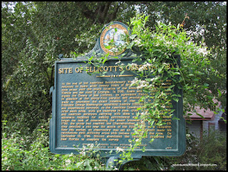
The second one was a sign telling about the Site of the Ellicottes Observatory. At the end of the American Revolutionary War in 1783, Florida was returned to Spain after twenty years of British control. Controversy soon arose over the exact location of the boundary between Spanish Florida and the state of Georgia. In 1795, Spain and the United States signed the Treaty of San Lorenzo, an agreement fixing the boundary in question at the thirty-first parallel and providing a survey to be made to determine the exact location of that line. In May, 1796, President George Washington appointed Andrew Ellicott, a mathematician and experienced surveyor, as the American Commissioner for the survey. After much delay, work got underway in June, 1798. A party of Spanish and American surveyors carrying with them a large accumulation of apparatus required for making astronomical and land measurements began the task of determining the exact boundary line. By August, 1799, the group had reached the Chattahoochee River. On August 23, they selected a site near the mouth of the Flint River as a campsite. Near this marker, an observatory was set up. Here Ellicott made his calculations until difficultly arose with Indians residing in the area. On September 18, 1799, Ellicott abandoned the camp and departed for East Florida to complete the survey. These landmarks were right where they said it would be ~ Yay!!!

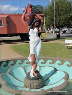
Then right in the middle of the town of Chattahoochee we found two more ~ at Heritage park. A train caboose ~ This Caboose was once a member of the Soo Line Railroad which was "the primary United States railroad subsidiary of the Canadian Pacific Railway (CP), controlled through the Soo Line Corporation, and one of seven U.S. Class I railroads." This Static display of this caboose is a landmark of the Town of Chattahoochee,Fla. The Park is a historical dedication to riverboats and the Apalachicola Northern Railroad Greensboro Depot Est. 1907 which once was the main source of commerce for this small town and The Fountain of the Living Water ~ while we were there I had to also include a mural painted on the wall and an old wagon....


Also there were 2 Woodsman of the World grave Markers at Mount Pleasant Cemetery right outside of town. We found them both right away with our GPS. The first one was Charles B. Johns Sr (1869 -1923) and the other was J.W. Shaw (1861-1926). To find out more about Woodsman of the World Grave Markers click here.


It was a fun day looking for these things and we really enjoyed the ride in the country looking for them. Begin having fun waymarking by registering at Waymarking.com.
Now this is something my honey & I will really enjoy....
Have Fun, Travel Safe & Stay Healthy!!!


